
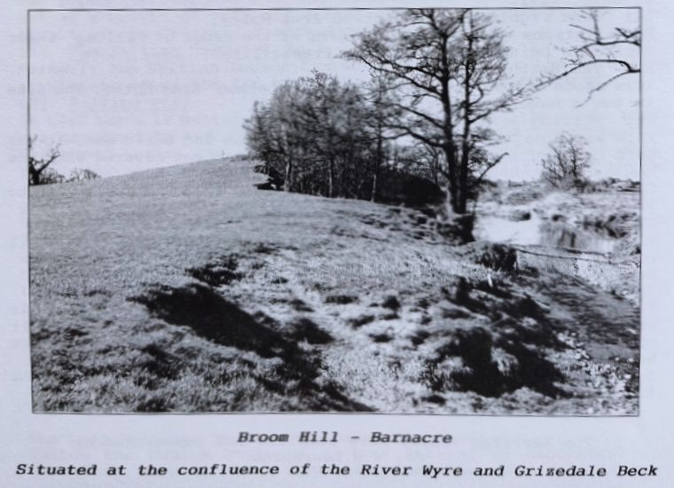
Broom Hill - Barnacre
Broom Hill is in the parish of Barnacre with Bonds. It is approximately 200 metres from the ford on Wyre Lane at SD.464478 on the Pathfinder 668 ordnance map. The Hill is circular, about 50 metres in diameter and rising to about eight metres at its centre. The north side of the feature has been badly eroded by the river Wyre; well over a third of this has been washed away. Over the years many ideas as to the purpose of this artificial mound have been submitted, from an Iron Age fort to a Saxon Moot Hill where the elders of Garstang met. A more likely theory is that we have a Bronze Age burial tumulus, or round barrow, that was used much later in history as a Saxon Moot.
Members of Pilling Historical Society visited the site on the evening of 17th July, 1999. Although the north side has suffered very serious erosion, it was still possible to work out the extent of the boundary. Because of the exposed state of the north face, members were able to examine the construction materials of the mound. These appeared to be river stone and gravel. However, on the two exposed extremities, there seemed to be random dry stone walls, although these would need further examination. It was felt that more detailed investigation in the future would prove the origins of the feature.
WYRE LANE FORD
Whilst investigating Broom Hill, it was decided to look at the ford, as some two years ago, during an excavation at the home of Mr. and Mrs. Higginson at Cabus, a section of the Walton-le-Dale to Lancaster Roman Road was exposed. (See Vol. VII Over-Wyre Historical Journal). This length of road appeared to be running southeast, away from Garstang and on a direct line towards the ford. After some discussion it was felt by those present that the ford may well be of Roman origin and is also worthy of further investigation.
MONK HOLES
Whilst in conversation with Mr. W. H. Lawrenson, he recalled that many years ago, he and some other members of the Society had been looking at an old map of the Skitham area and had noticed a reference on the map to Monk Holes; these being marked as six circles on the map. The 1840 ordnance maps were searched but no reference to them could be found. Mr. Lawrenson contacted Mr. Walter Lawrenson who has a copy of the 1826 tithe map for the area and they were located on this map. From their close proximity to Ridgy Pool and the layout of the circles, is it possible that these could have been fishponds? The Society would be glad to hear from anyone with information on the above.