
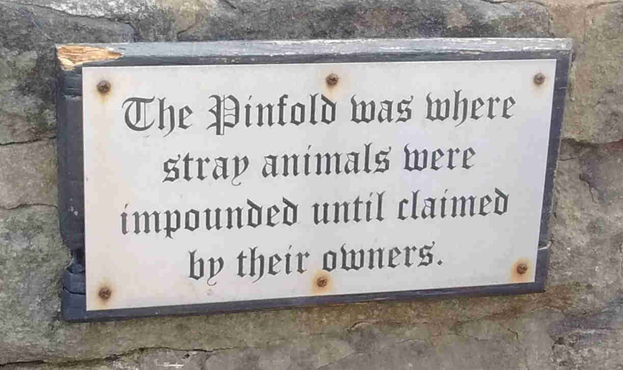
Amounderness Pinfolds
A pinfold (OE. pundfald) is an enclosure for cattle or other animals that have been found roaming the streets or trespassing on land for which the owner of the animals does not have permission. The animals would then be restrained in the pinfold until the owner redeemed them - normally by paying a small fine. Pinfolds were primarily found in villages from, at least, the middle ages onwards but towns, especially those with a regular market, would possess one or more pinfold. The Fylde was no different and it appears that all of the existing pinfolds have, over the years, had major renovation. This isn't surprising and, given the nature of the structures, all of them would need regular maintenance.
The first mention, outside of Preston, I can find that refers to a pinfold occurs in the Clifton Court record for 1677 where John Charnley is fined 12d for laying carrion in the pinfold. The following year, James Clifton was fined for breaking the pinfold.
Kirkham
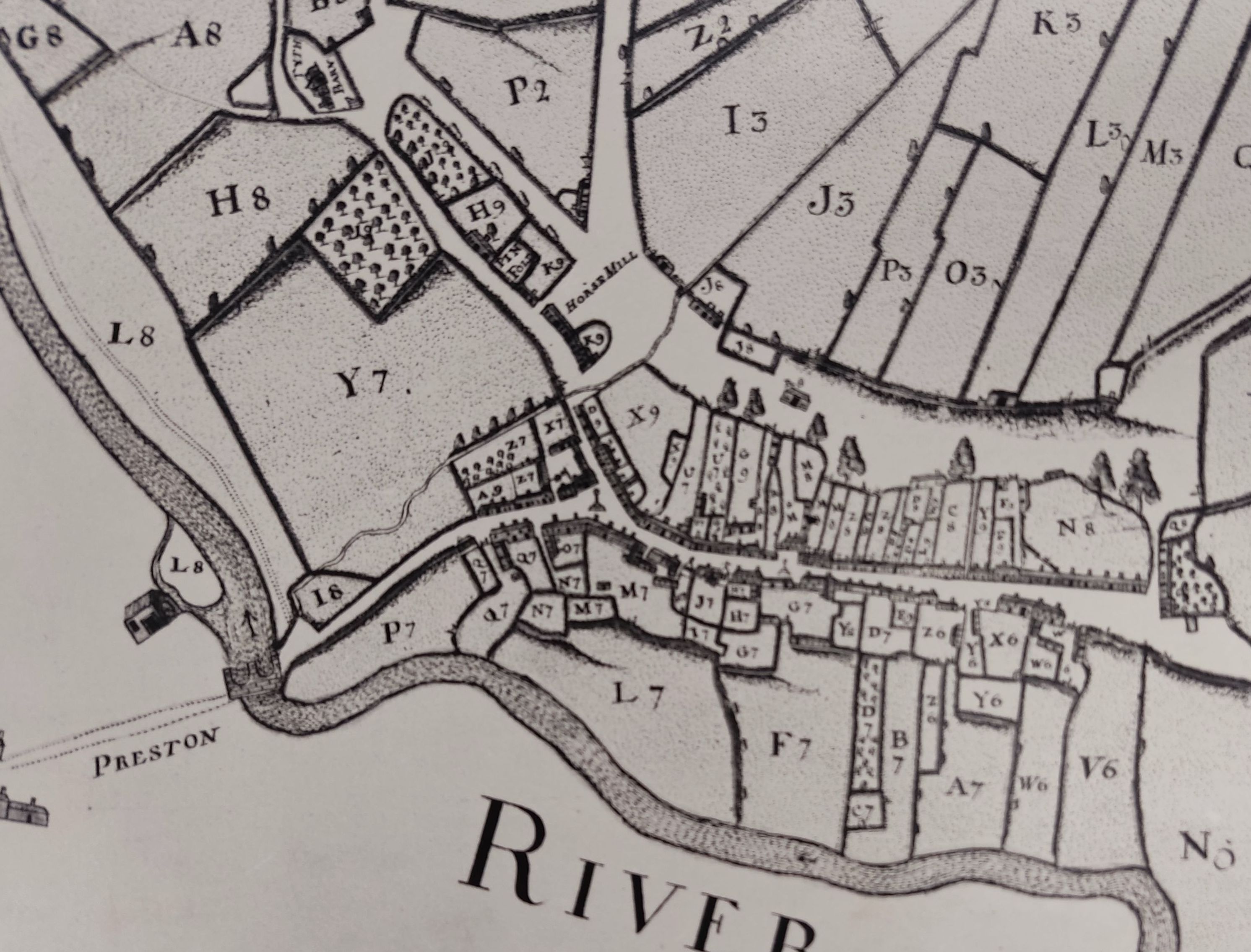
The first record of a pinfold in the Kirkham area appears in the "History of Kirkham in Amounderness" by R Cunliffe Shaw. In it he mentions that, around 1286 at Ribby, strays were received from Amounderness. In the same book he mentions that the pinfold was on Moor lane and, by 1872, had gone into misuse and was sold. The image below shows the position of the original fold.
Wrea Green
In 1902 the pinfold land was conveyed to the trustees of Wrea Green Endowed school from Evan Ainsworth. This would have been across Station road from the Grapes pub.
Pilling
From Pilling Parish pinfold article
Pilling pinfold appears on a map of 1734 and on the OS map of 1845. By 1893 it has disappeared. Adjacent to the footpath opposite the Old Shop Inn on School lane.
“Tended by some old person to be hired at the expense of the owners of the goods for that purpose but we strictly order and direct that no child or children shall on any account or under any pretense be permitted to look after such cattle in as much as such practice tend to hurt the morals of youth and bring them up in sloth and idleness” 1807
1805 fines were as follows:-
Goose 1/4d, Swine 1d, Sheep 2d, Calf 3d, Colt 3d, Cow 4d, Horse 4d
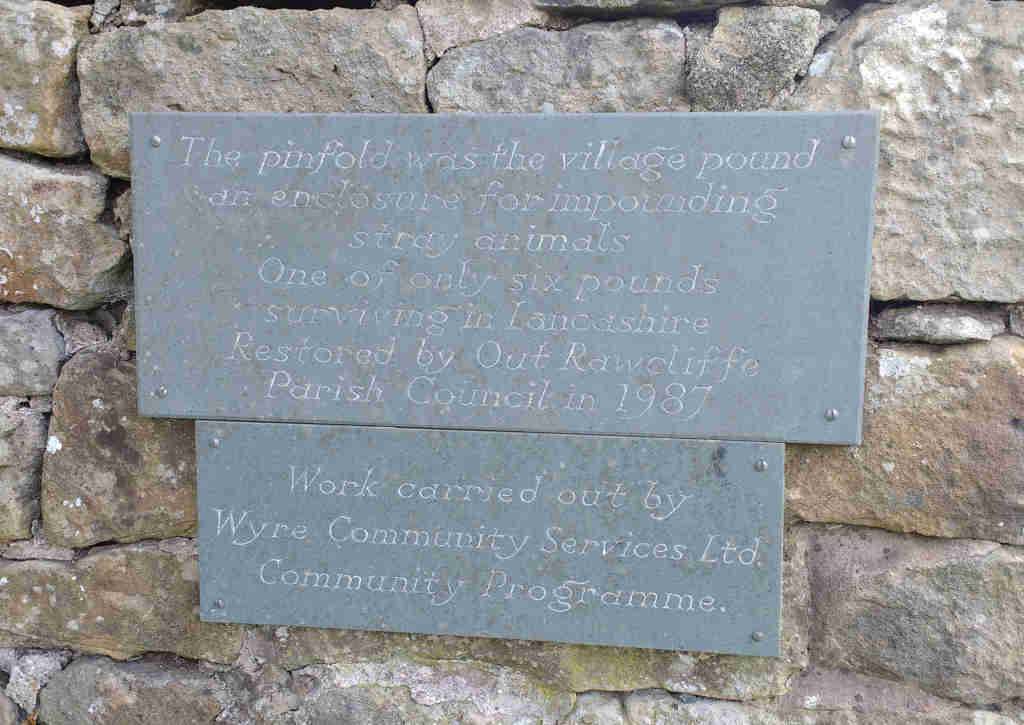
Of the 38 pinfolds in the western part of Lancashire only four survive (as of 1997) - Out Rawcliffe, Ellel, Slyne and Broughton.
In 1997 Pilling Parish Council resolved that part of the village history should be re-built, in the Pinfold, which could form part of the local history projects for local schools. Funds were secured….re-opening on the 26th September, 1997.
Garstang
The first occurence of a pinfold in Garstang appears in an undated map but appears to be around 1650.
By the first edition OS map the pinfold had moved to the northern side of the town - near to the present Garstang United Reform Church. This is marked as Independent Chapel in the OS map.
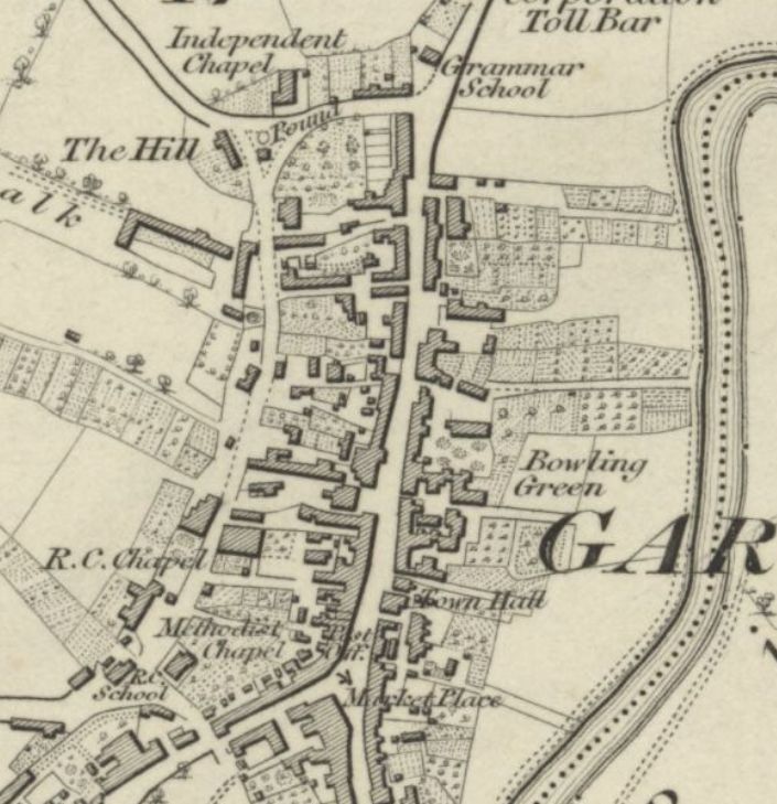
By the 1890's maps all sign of the pinfold had disappeared.
Broughton
For a full description of this pinfold go to Broughton pinfold
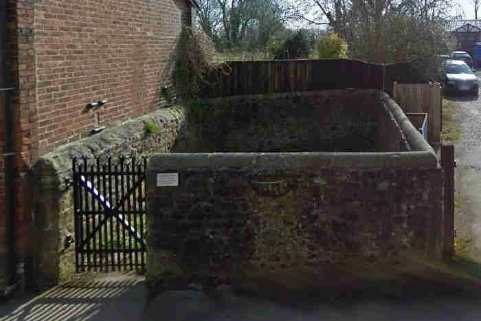
Great Eccleston
This pinfold still exists but, probably, in a cut down form. Found on the western end of the main street.
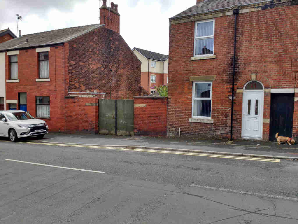
Poulton-le-Fylde
Although it never appears on any of the OS maps, supposedly there was a pinfold on wasteland in Back lane (now Chapel St) between the Thatched house & St Chads.
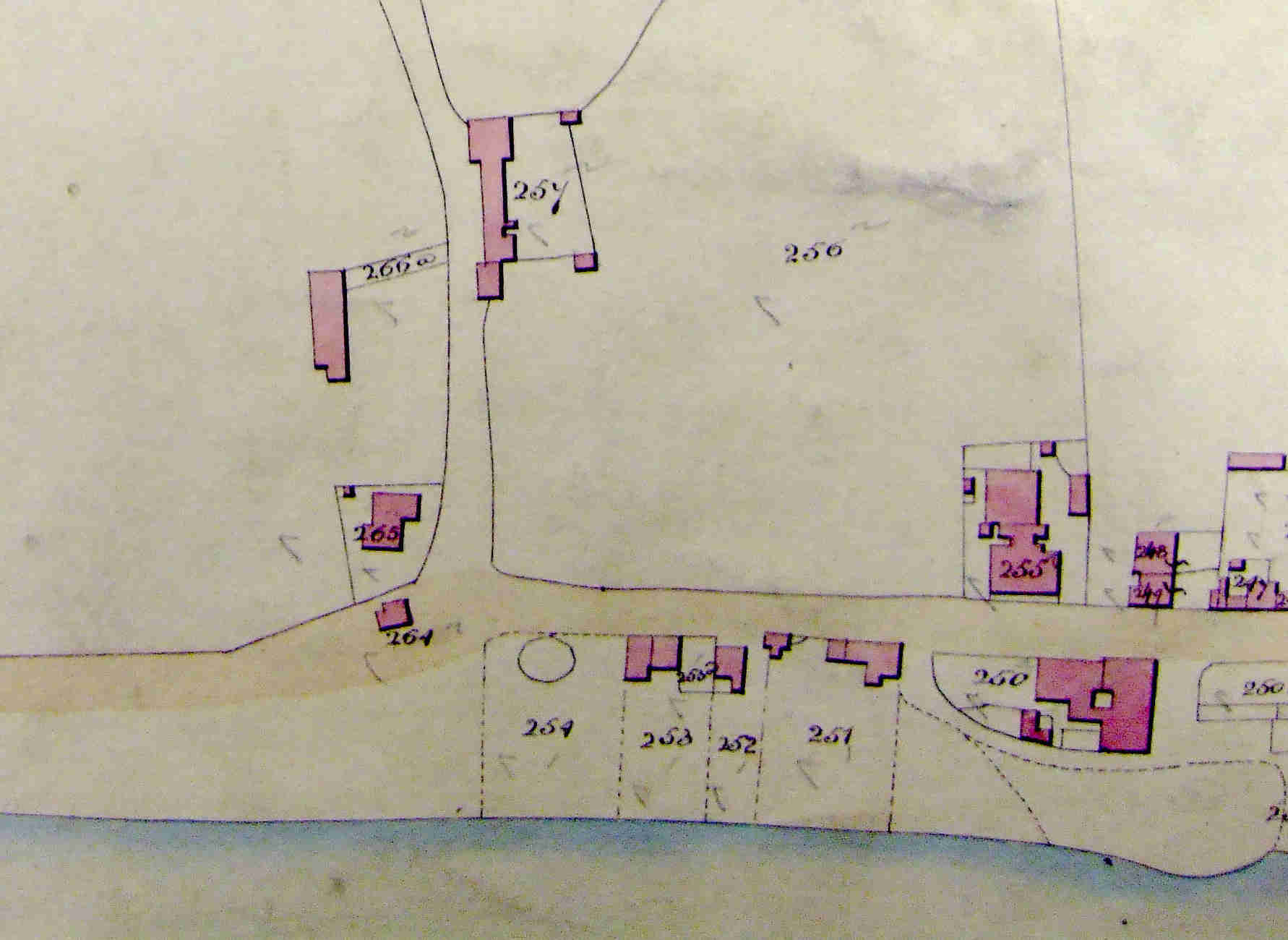
Lytham/Blackpool
In Porter's "History of the Fylde of Lancashire" he mentions a quadrangular pinfold made of cobbled stones near the entrance to Lytham Hall. Also there is a similar description of cobbled pinfold, this time circular, close to the centre of Blackpool.
Attached is a section of the Layton with Warbreck Tithe Map of 1838, showing the area once known as Lower Blackpool, but which is now the junction of Chapel Street and the Prom near Central Pier. Plot 254 is “Pinfold and Waste”, then owned by Sir P. H. Fleetwood and occupied by Thomas Warbreck. In 1851, Robert Bickerstaffe built the Wellington Hotel on the site of the Pinfold. The pub was largely rebuilt in the early 1950s.
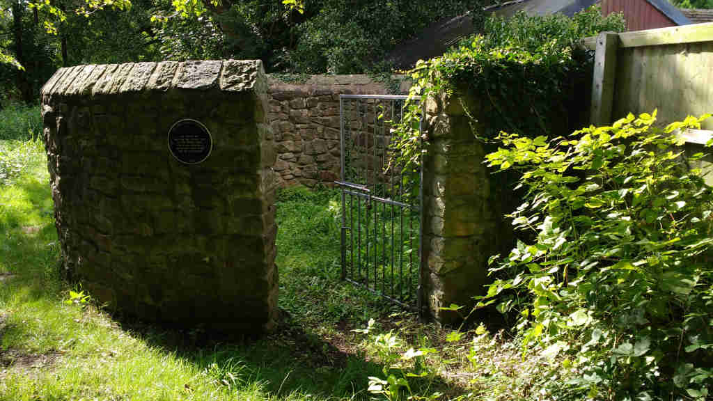
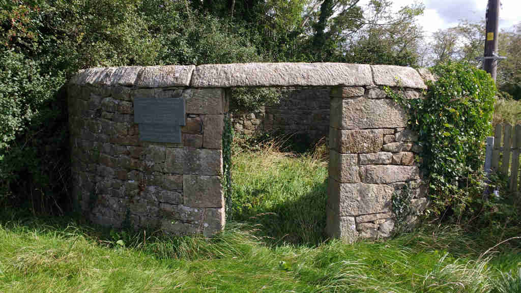
Out Rawcliffe
Fortunately, photographic records exist for this pinfold. The earliest one, taken by John Maynard Tomlinson around 100 years ago, shows the fold away from any habitation. It could well have still been in use at this time.
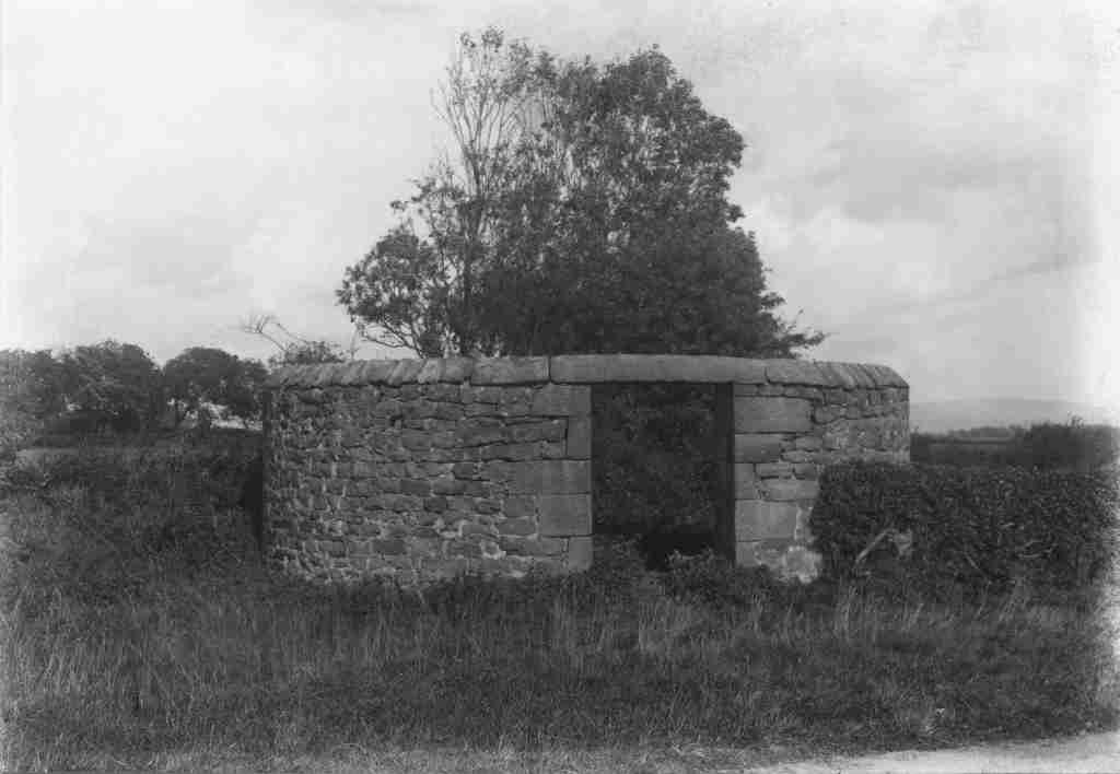
Scan courtesy of Ted Lightbown.
The next image, from around 50 years ago, shows that "civilization" in the form of telegraph poles encroaching around the fold.
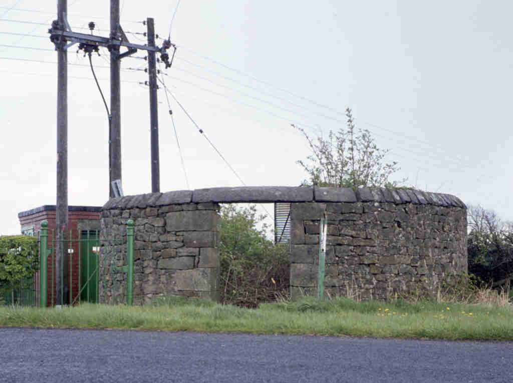
Photo courtesy of Ted Lightbown
This pinfold was restored in 1987.
And now a modern view (1/9/2019)
Cabus
"There were three pounds into which stray animals were put, one near the Old Post Office (now Sedgewick's Yard), at Artlebeck Bridge the stone wall before the iron railings was part of the pound, and one at Mary Bank, Caton Green is still visible."
Others
There had to be a number of other pinfolds in the Amounderness (and its periphery) area, if only from the number of pinfold lanes.
Pinfold lane - north of the Lune in Lancaster
Pinfold lane and farm - between Grimsargh and Longridge
Ellel - this is mentioned by Wyre Borough in the article on the Pilling pinfold but I can find nothing in the written records.
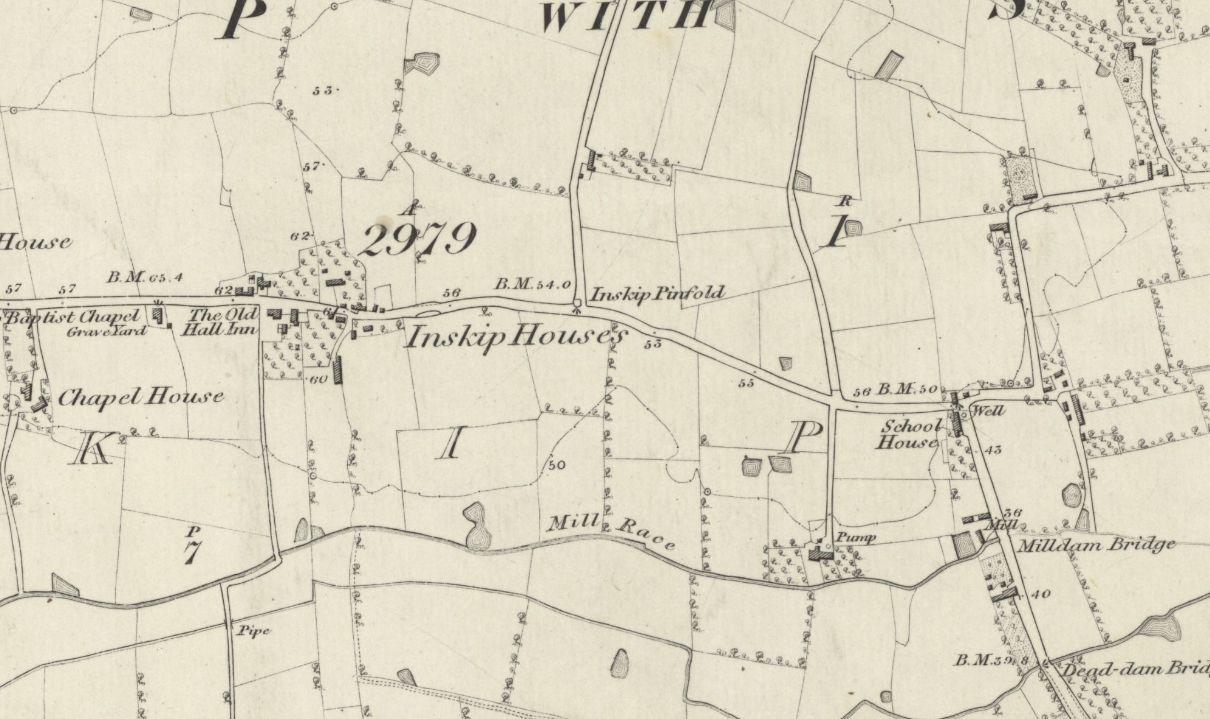
Pinfold lane - Sowerby/Inskip. The OS shows its position.
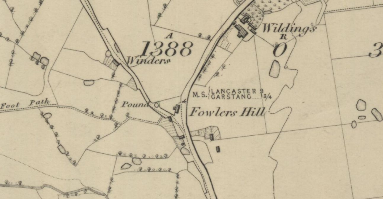
When looking at the first edition OS maps for a possible Roman road at Cabus a "pound" was found at Fowlers Hill
On the Kirkham & Wesham Memories of the Past Facebook page a responder mentioned that the pinfold on the Lord Derby Estate in Treales was called "locking stoops".