
Historical Background
Antiquarian speculation about Roman roads in the western Fylde had its dubious origins in the publication by Bertram and Stukeley of the Itinerary of Richard of Cirencester in 1755. William Stukeley (1687-1765) was a well known antiquary whose enthusiasm for ancient Britain had earned him the nickname “the Arch-druid”; he even had a replica henge in his grounds. It is still “discovered” from time to time. One of his stranger notions was that the Romans had been divinely inspired to build their roads “for the naked feet of the apostles”! Charles Bertram, a professor of English in Copenhagen, had persuaded Stukeley that the itinerary in his possession had been copied by Richard, a 14th century monk, from original Roman documents. To quote from Stukeley's book A Medallic History of Carausius of 1757:—
“Our writers scarce knew, that the Romans had conquered this country, till Richard de Cirencester's manuscript was brought to light. I have induced my friend, the owner of it, at Copenhagen, to print it. It gives more light into Roman Britain than any thing we have yet seen.”
Among the routes described in the itinerary was one crossing the country west to east, from “the port of the Sistuntians to Eboracum [York]”. From then on, practically every history of Lancashire, or a part of it, included a discourse on some aspect of the itinerary, the most popular being the location of the port at the western end of the route.
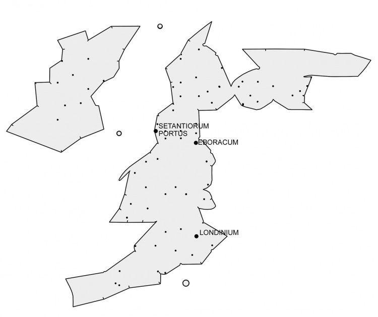
The map of the British Isles above has been constructed from co-ordinates given by the Alexandrian geographer, Claudius Ptolemy (c. 90-168 A. D.). The proximity of ‘Harbour of the Setantii’ to ‘Moricambe Estuary’ offers no real clue to the location of the former, for the modern Morecambe Bay is thought to have been named after Ptolemy's place-name by the topographer, William Camden (1551-1623). A bay on the Solway Firth was similarly named in post-medieval times.
A hundred years was to pass before Richard's work was generally acknowledged to have been a forgery based upon Ptolemy's Geography and other itineraries. During that time it had caused a great deal of damage and confusion.
In 1837, Rev. William Thornber (1803-85) in his History of Blackpool and its Neighbourhood argued that there was no evidence to support the conclusion of Rev. John Whitaker (History of Manchester, 1775) and of his son Dr. T. D. Whitaker (History of Richmondshire, 1823) that the Portus Setantiorum had been on the Ribble at Freckleton Naze. Instead, he suggested that it had stood on the Wyre and maintained that:—
‘The vestiges of and agger, immemorially called the “Danes' Pad”, from the tradition that along it those plunderers penetrated into these parts is yet so distinctly discernable on the Warren near the mouth of the Wyre, at Staining and the low moss lands near Mythorp, that Dr. Whitaker is constrained to admit there was a branch from the great Roman road to this port.’
For the record, Thornber's had not been the first written mention of ‘Danes' Pad’; Edward Baines had used the term on page 377 of his History of Lancashire, published just one year earlier.
Victorian Rationalism
In the early 1840s, William Thornber convinced John Just, a Bury schoolmaster with a great interest in Roman roads, and the officers of the Ordnance Survey, then preparing the first six inch to the mile map of the area, that there were traces of the road to be seen in several places. These were duly represented on the map, being indicated by double lines. Elsewhere, the assumed course of the road was shown by a single dotted line.
The founding of the Historic Society for Lancashire and Cheshire in 1848 appears to have stimulated antiquarian research in the area, for in 1851 papers by Thornber, Just and Langton Birley, describing the Danes' Pad, were read and published. Ironically, John Just's paper is followed in the transactions by a letter from J. Robson expressing doubt about the authenticity of Richard's itinerary.
A Storm in Any Port
The itinerary was finally shown to have been forged by Bertram in an article by B. B. Woodward for the Gentlemans' Magazine of 1866-7. By that time, the realisation that it was a fake had little effect on the case for the road through the Fylde for, after all, traces of it had been found. In any case, Portus Setantiorum, the Danes Pad's assumed raison d'être, was still mentioned in Ptolemy's list of co-ordinates, which, however inaccurate, placed it somewhere on the north west coast of Britain — and the Wyre was as good a place as any.
Several attempts were made to compensate for the distortions and errors in Ptolemy's coordinates, and thereby determine the true location of the Portus, using quite elaborate techniques. Somehow, these usually managed fortuitously to place the harbour where each antiquary-cum-mathematician had thought it had been in the first place, which also tended to be near each one's particular area of interest. A full account of the arguments for the positioning of the Portus may be found in the first chapter of Hardwick's History of Preston, 1857, and a good example of the application of mathematics to the problem is in Stan Jones' Was Lancaster Camelot?, 1992.
Thornber thought that the Roman harbour had been on the Wyre in the area of Stanah or Skippool. John Porter, however, in his History of the Fylde of 1876, used Thornber's evidence, the interpretation of Ptolemy's co-ordinates and assumptions about the coastline in Roman times to advance a theory that placed the harbour out beyond North Wharf sand bank, north of Fleetwood.
Despite being highly speculative, Porter's theory has held sway in the popular mind ever since, being helped, no doubt, by his book's popularity and accessibility. And, once the Portus is accepted as having been at the mouth of the Wyre, it follows that the Danes' Pad must have existed in order to reach it. But many supporters of Porter's theory will readily turn this argument around and assert that the Portus must have been at Fleetwood, because that is where the Danes' Pad leads.
A similar circular argument says that Portus Setantiorum must have been in the Fylde, because the Setantii are known to have inhabited the region. Yet, despite all that has been written about the Setantii and their way of life (usually based upon etymology and the attributes of the Brigantes), the only mention of such a tribe to come down from antiquity is in the single co-ordinate given by Ptolemy.
Modern Scepticism
Antiquarianism in the Fylde was given its own monument in 1937 with the publication of Amounderness — the report of the Fylde Region Joint Town Planning Advisory Committee. This lavish and pretentious book, published by Batsford for the consultants Thomas Mawson and Son, might be imagined to have concerned itself just with the present and future of the Fylde. Instead, it happily and uncritically recounted Porter's theory, John Just's description of the Danes' Pad and much local history, some little more than folk-lore.
The book's official appearance gave credence and authority to much of its content. It now commands high prices and no doubt has many of its purchasers hanging on its words (excluding, perhaps, its recommendations for sea-plane bases). To give an objective assessment of Amounderness, it is necessary only to quote the late well-respected local historian, Hugh Sherdley of Pilling, who, when asked his opinion of it during a night-school class he was conducting, replied “It's a load of rubbish”.
In fairness, Mawson did publish an alternative view of the Danes' Pad, in the form of a letter written to him in January 1934 by J. Burrows of Poulton, the Local Representative of the Ancient Monuments Board. It states:—
“With regard to the Dane's Pad, the only evidence that exists, relates to a raised path, probably of neolithic age, which stretched in Porter's days from near Weeton Railway Bridge across the valley of the Main Dyke to Mythop. It has long since vanished. . . .
“All the rest of the ‘Roman Road’ from Ribchester to Poulton rests on the imaginative accounts of Just and Thornber, both of whom were without any status as observers. The rest of the ‘authorities’ are mere quoters from Thornber.
“The late Mr. Clemesha and I actually walked over the whole of the alleged route, armed with the six inch Ordnance Survey Map, and nowhere found the slightest resemblance on or under the ground of a paved road. My finds at Kirkham have no relevance.”
Burrows and Clemesha had examined the route prior to 1924 and had come “to the definite conclusion that such a road never existed”. They had apparently then persuaded the Ordnance Survey to give “an intimation that the road will not appear on future maps”.
Ironically, after many years absence from one inch O.S. Maps, the Danes' Pad has found its way back on to the latest metric equivalent map.
In February 1937 a letter by Reginald Sharpe France, the Records Secretary and founder of the (Blackpool &) Fylde Historical Society and later Lancashire's first County Archivist, appeared in the West Lancashire Evening Gazette. It was mainly concerned with the supposed lost coastal village of Singleton Thorp, but included the following paragraph:—
“It is obvious, to take the most charitable view, that the Rev. William Thornber, B. A. was an incurable romantic (the Danes' Pad is also to be debited to him), and that he has misled many thousands of people, either directly or indirectly, through his fairy tales having been copied into other books.”
To take the most charitable view of Sharpe France's letter, its arrogant tone aside, the criticism of Thornber is almost entirely unjustified. Earlier sources can be found for practically everything for which Thornber has been pilloried by subsequent writers. In the case of Singleton Thorp and Waddum Thorp, he had apparently relied upon Peter Whittle (Marina, 1831) for his basic information. Contrary to what might be expected from an “incurable romantic”, examples of caution and candour will be found among Thornber's writings in this book.
Clearly, to be able to assess the subject objectively, it will be necessary to examine the evidence in detail. To do this, it is proposed to trace the course of the Danes' Pad westwards from Kirkham.